
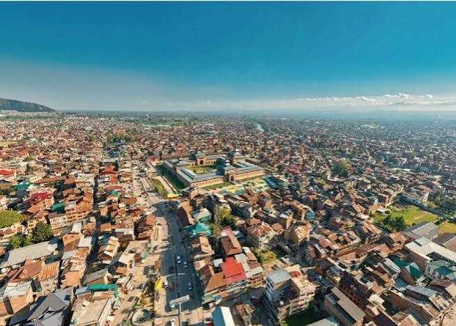
This exposes the central paradox of urbanisation in Jammu and Kashmir: there are cities with plans that are inadequately implemented, alongside settlements where urban growth is taking place without sufficient planning. In both situations, the outcome is a widening disconnect between the statutory city and the functional city
Urbanisation in Jammu and Kashmir is a study in contrasts. Cities and towns across the Union Territory are spreading rapidly, their built form changing at unprecedented pace.These are undergoing rapid physical transformation and spatial spread, yet the nature and quality of this metamorphosis is complex considerably .The liveability, the coherence, the basic fairness of everyday urban life is lagging far behind the physical expansion. We usually talk about the gap between the city envisaged on Master Plan maps and the city people actually walk through, work in and call home. In Jammu and Kashmir the picture is more complicated. There is a third reality that receives far less attention: the many settlements and expanding edges where meaningful spatial planning has simply never taken hold, or remains too weak to matter. The three geographies i.e. the planned city, the city that has grown around or against the plan, and the city growing in a near-total planning vacuum, defines the urban condition of the region today. The numbers too call for an urgent attention and make the urgency vividly clear. Urban areas have risen from 86 in the 2011 Census to well over 100. The urban population has climbed from roughly 3.43 million to an estimated 4.25 million. Growth is real and accelerating in amorphous and an unintended tracjectory. What has not kept pace is the institutional ability to understand it, guide it, optimize benfits out of it and manage it. Planning instruments remain uneven in coverage, outdated in places, and weakly implemented almost everywhere as such urbanisation is outrunning the system meant to shape it.
In theory, a statutory Master Plan comes first and then development follows its logic. In large parts of Jammu and Kashmir the sequence has been reversed. Houses go up, commercial strips spread along roads, agricultural land is subdivided, and only later does the planning office arrive, armed with maps that no longer match the ground realities. This is retroactive planning: the difficult, expensive business of trying to regularise, retrofit or repair an urban form that has already set. Roads end up narrow and discontinuous. Drainage lines are blocked. Open spaces vanish. Infrastructure corridors are built over. Providing basic services becomes a constant struggle against patterns already locked in by private decisions.
The Third Map: The City Without Effective Planning
The conventional planning approach assumes that a statutory plan precedes urban development and provides the framework within which subsequent growth takes place. The experience of Jammu and Kashmir increasingly challenges this assumption. In many settlements, the sequence has been reversed. Housing expansion, roadside commercialisation, subdivision of agricultural holdings, conversion of residential premises into commercial establishments, ribbon development and dispersed peripheral construction have preceded the preparation or effective implementation of spatial plans. Planning institutions often intervene only after the settlement pattern has consolidated and the possibilities of orderly development have considerably diminished. This phenomenon may be described as retroactive planning comprising a situation in which planning authorities are required to regularise, retrofit, restructure or repair an urban form that has already emerged through individual decisions, spontaneously and incremental development. Such an approach is inherently more difficult and expensive than planning in advance. Roads become narrow and fragmented, drainage networks lose continuity, public spaces disappear, infrastructure corridors become obstructed and the provision of essential services ,amenities and facilities becomes increasingly constrained by existing development patterns.
The Master Plans acknowledges several of these implementation challenges. It recognises that even where Master Plans exist, planned development has remained difficult to achieve because of landownership constraints, inadequate financial resources, difficulties in land procurement and limited implementation capacity. It further highlights that planning proposals frequently remain confined to statutory documents because local authorities lack the financial and institutional means to translate proposed infrastructure and land-use interventions into reality. This exposes the central paradox of urbanisation in Jammu and Kashmir: there are cities with plans that are inadequately implemented, alongside settlements where urban growth is taking place without sufficient planning. In both situations, the outcome is a widening disconnect between the statutory city and the functional city. The challenge is therefore not simply to prepare more plans, but to ensure that planning precedes development, responds to existing urban realities and possesses the institutional capacity to influence actual land-use decisions. The peri-urban fringe deserves special attention. It is no longer quiet countryside waiting its turn. It is a messy, active transition zone of agriculture, housing, warehouses, institutions, tourism facilities, commercial strips, roads and environmentally sensitive land all mixed together. Treating it as residual space under either rural or metropolitan rules no longer works. It needs its own planning approach.
Informality, too, needs a more honest reading. It is often treated as pure failure or defiance. In reality it is frequently a signal that formal systems are not meeting real demand. When affordable housing is scarce, people build incrementally. When formal commercial space is too expensive or poorly located, trade moves to the street or the fringe. When public transport is inadequate, private vehicles and informal modes fill the gap. Informality is often the city’s way of solving problems the formal system has left unsolved. That does not mean every informal structure should be accepted. Building on floodplains, steep unstable slopes or critical infrastructure corridors creates real public danger and must be stopped. But a planning response that only polices and demolishes without addressing the underlying shortages of land, housing and services will keep failing. These realities call for a clearer shift in how we plan. The system needs to move from a narrow permission-based model to a performance-based one. The question cannot stop at whether a building meets a setback or floor-area ratio. We must also ask whether it has proper access, drainage, parking, water supply, sewerage, waste management and enough surrounding infrastructure capacity. Building rules cannot replace spatial planning. The Master Plan should decide where development belongs, at what intensity and under what conditions. Building regulations should then decide how that development must perform. A fully compliant building in the wrong place is still a planning failure.
Missing Layer: Zonal and Local Area Planning
The next generation of J&K planning must therefore move from the broad Master Plan to the Zonal Plan, Local Area Plan and neighbourhood scale. Master Plans provide strategic direction, but they cannot resolve every street, drainage channel, public-space requirement, pedestrian connection or neighbourhood facility. The Srinagar Master Plan 2035 itself recommends accelerated preparation of Zonal Plans and improvement of urban-fringe settlements through a neighbourhood approach. This should become a system-wide priority. Every expanding urban settlement should have a hierarchy of plans comprising of relation to Regional Plan with detailed Master Plan and Zonal Plan.Furtherit has to be detailed out as Local Area Plan or Infrastructure Plan with defined Development Control Regulations. Without this planning cascade, Master Plans would remain broad spatial documents while actual development decisions continue to occur parcel by parcel without any coherence and complianc to planning framework.
Planning the City that Exists
The traditional planner often starts with vacant land and asks: “What should be built here?” J&K increasingly needs a different question: “How do we improve what has already been built?”This means shifting from greenfield planning towards brownfield planning, urban restructuring, retrofitting and regeneration. Existing colonies need drainage networks. Existing commercial streets need pedestrian management. Existing settlements need public spaces. Existing peripheral areas need trunk infrastructure. Existing informal settlements need infrastructure upgrading and, wherever feasible, tenure and service security. This is particularly important because large-scale displacement is neither socially desirable nor financially realistic. The planning objective should be integration before demolition, upgrading before eviction and regulation before prohibition, except where development creates demonstrable environmental or public-safety risks At the same time we must stop planning only for empty land. Much of the city already exists. Large-scale demolition and displacement are neither socially acceptable nor financially realistic. The more useful questions are: how do we improve what is already built? How do we add drainage to existing colonies, pedestrian space and parking management to commercial streets, trunk infrastructure to peripheral settlements, and basic services plus progressive tenure security to informal areas? Integration before demolition, upgrading before eviction, and regulation before prohibition with exceptions only where real environmental or safety risks exist and shall guide the approach. Brownfield work and neighbourhood-level improvement must become central priorities alongside planning for future growth.
Need for Pragmatic Master plans
The practical answer is a living urban planning system rather than another round of static Master Plans. Jammu and Kashmir needs a continuously updated geospatial platform that brings together land records, land use, building footprints, roads, drainage, utilities, environmental constraints, public facilities and development permissions. Satellite imagery, GIS, drones, digital permission systems and basic artificial intelligence can turn monitoring from an occasional exercise into a continuous one. Significant changes in land use should appear on a planning dashboard in near real time. Major new construction or subdivision should be checked against infrastructure capacity and spatial policy before, not after, the fact.
Urban Policy Imperatives
In J&k Future urban policy needs to rest on five practical principles: plan the wider region; structure the metropolitan and peri-urban edges properly; retrofit and upgrade existing settlements; integrate legitimate informal activity where it can be made safe and serviceable; and monitor urban change continuously. In practice this means ensuring every recognised urban area and significant peri-urban settlement has an appropriate planning framework and role so that the absence of a Master Plan can no longer excuse unguided growth. It means building a real hierarchy of plans that are linked to livability, economy, projects, sustainability and enforceable rules. It means creating implementation capacity with professional staff and genuine coordination across agencies. It means treating existing unplanned and informal areas with a differentiated, risk-sensitive approach to upgrade and integrate where possible, regulate firmly where necessary, relocate only when unavoidable. It means giving brownfield and neighbourhood infrastructure the same priority as new expansion. It means building a shared geospatial platform that supports decisions, permissions and enforcement. It means treating small-town and peri-urban planning as a distinct priority rather than an afterthought. It means tying development permissions to actual infrastructure capacity and environmental performance. And it means opening planning to genuine public participation so that communities, local businesses and elected representatives help set priorities and track results. In the end, the success of urban planning in Jammu and Kashmir should not be counted by the number of Master Plans prepared, the volume of building permissions issued, or the formal rate of regulatory compliance. It should be judged by whether people can find safe housing, reliable water and sanitation, decent mobility, usable public spaces, real economic opportunities and a healthy environment. The goal is settlements that are not just physically urban but functionally efficient, socially inclusive, economically productive and environmentally resilient. The future of urbanisation here will depend on whether we can close the gap between the city planners draw and the city people live in, while bringing real planning to the many places where urbanisation is only now beginning. That requires moving decisively from plan-making to plan implementation, from reactive regulation to anticipatory governance, and from isolated plot-by-plot permissions to integrated spatial management. The real task is to plan the city as it exists and, more importantly, to plan the city before it emerges.
Jammu and Kashmir does not need a rigidly controlled city that ignores everyday needs, nor an uncontrolled city shaped only by individual decisions. It needs a living urban system in which planning, infrastructure, institutions and daily urban life keep informing and strengthening one another. That is the shift we must make, from urbanisation as simple physical expansion to urban development as a deliberate tool of economic progress, environmental security and social transformation.
Email: --------------------------- hamwani24@gmail.com

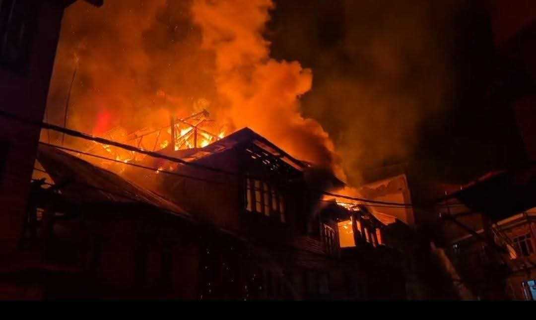

This exposes the central paradox of urbanisation in Jammu and Kashmir: there are cities with plans that are inadequately implemented, alongside settlements where urban growth is taking place without sufficient planning. In both situations, the outcome is a widening disconnect between the statutory city and the functional city
Urbanisation in Jammu and Kashmir is a study in contrasts. Cities and towns across the Union Territory are spreading rapidly, their built form changing at unprecedented pace.These are undergoing rapid physical transformation and spatial spread, yet the nature and quality of this metamorphosis is complex considerably .The liveability, the coherence, the basic fairness of everyday urban life is lagging far behind the physical expansion. We usually talk about the gap between the city envisaged on Master Plan maps and the city people actually walk through, work in and call home. In Jammu and Kashmir the picture is more complicated. There is a third reality that receives far less attention: the many settlements and expanding edges where meaningful spatial planning has simply never taken hold, or remains too weak to matter. The three geographies i.e. the planned city, the city that has grown around or against the plan, and the city growing in a near-total planning vacuum, defines the urban condition of the region today. The numbers too call for an urgent attention and make the urgency vividly clear. Urban areas have risen from 86 in the 2011 Census to well over 100. The urban population has climbed from roughly 3.43 million to an estimated 4.25 million. Growth is real and accelerating in amorphous and an unintended tracjectory. What has not kept pace is the institutional ability to understand it, guide it, optimize benfits out of it and manage it. Planning instruments remain uneven in coverage, outdated in places, and weakly implemented almost everywhere as such urbanisation is outrunning the system meant to shape it.
In theory, a statutory Master Plan comes first and then development follows its logic. In large parts of Jammu and Kashmir the sequence has been reversed. Houses go up, commercial strips spread along roads, agricultural land is subdivided, and only later does the planning office arrive, armed with maps that no longer match the ground realities. This is retroactive planning: the difficult, expensive business of trying to regularise, retrofit or repair an urban form that has already set. Roads end up narrow and discontinuous. Drainage lines are blocked. Open spaces vanish. Infrastructure corridors are built over. Providing basic services becomes a constant struggle against patterns already locked in by private decisions.
The Third Map: The City Without Effective Planning
The conventional planning approach assumes that a statutory plan precedes urban development and provides the framework within which subsequent growth takes place. The experience of Jammu and Kashmir increasingly challenges this assumption. In many settlements, the sequence has been reversed. Housing expansion, roadside commercialisation, subdivision of agricultural holdings, conversion of residential premises into commercial establishments, ribbon development and dispersed peripheral construction have preceded the preparation or effective implementation of spatial plans. Planning institutions often intervene only after the settlement pattern has consolidated and the possibilities of orderly development have considerably diminished. This phenomenon may be described as retroactive planning comprising a situation in which planning authorities are required to regularise, retrofit, restructure or repair an urban form that has already emerged through individual decisions, spontaneously and incremental development. Such an approach is inherently more difficult and expensive than planning in advance. Roads become narrow and fragmented, drainage networks lose continuity, public spaces disappear, infrastructure corridors become obstructed and the provision of essential services ,amenities and facilities becomes increasingly constrained by existing development patterns.
The Master Plans acknowledges several of these implementation challenges. It recognises that even where Master Plans exist, planned development has remained difficult to achieve because of landownership constraints, inadequate financial resources, difficulties in land procurement and limited implementation capacity. It further highlights that planning proposals frequently remain confined to statutory documents because local authorities lack the financial and institutional means to translate proposed infrastructure and land-use interventions into reality. This exposes the central paradox of urbanisation in Jammu and Kashmir: there are cities with plans that are inadequately implemented, alongside settlements where urban growth is taking place without sufficient planning. In both situations, the outcome is a widening disconnect between the statutory city and the functional city. The challenge is therefore not simply to prepare more plans, but to ensure that planning precedes development, responds to existing urban realities and possesses the institutional capacity to influence actual land-use decisions. The peri-urban fringe deserves special attention. It is no longer quiet countryside waiting its turn. It is a messy, active transition zone of agriculture, housing, warehouses, institutions, tourism facilities, commercial strips, roads and environmentally sensitive land all mixed together. Treating it as residual space under either rural or metropolitan rules no longer works. It needs its own planning approach.
Informality, too, needs a more honest reading. It is often treated as pure failure or defiance. In reality it is frequently a signal that formal systems are not meeting real demand. When affordable housing is scarce, people build incrementally. When formal commercial space is too expensive or poorly located, trade moves to the street or the fringe. When public transport is inadequate, private vehicles and informal modes fill the gap. Informality is often the city’s way of solving problems the formal system has left unsolved. That does not mean every informal structure should be accepted. Building on floodplains, steep unstable slopes or critical infrastructure corridors creates real public danger and must be stopped. But a planning response that only polices and demolishes without addressing the underlying shortages of land, housing and services will keep failing. These realities call for a clearer shift in how we plan. The system needs to move from a narrow permission-based model to a performance-based one. The question cannot stop at whether a building meets a setback or floor-area ratio. We must also ask whether it has proper access, drainage, parking, water supply, sewerage, waste management and enough surrounding infrastructure capacity. Building rules cannot replace spatial planning. The Master Plan should decide where development belongs, at what intensity and under what conditions. Building regulations should then decide how that development must perform. A fully compliant building in the wrong place is still a planning failure.
Missing Layer: Zonal and Local Area Planning
The next generation of J&K planning must therefore move from the broad Master Plan to the Zonal Plan, Local Area Plan and neighbourhood scale. Master Plans provide strategic direction, but they cannot resolve every street, drainage channel, public-space requirement, pedestrian connection or neighbourhood facility. The Srinagar Master Plan 2035 itself recommends accelerated preparation of Zonal Plans and improvement of urban-fringe settlements through a neighbourhood approach. This should become a system-wide priority. Every expanding urban settlement should have a hierarchy of plans comprising of relation to Regional Plan with detailed Master Plan and Zonal Plan.Furtherit has to be detailed out as Local Area Plan or Infrastructure Plan with defined Development Control Regulations. Without this planning cascade, Master Plans would remain broad spatial documents while actual development decisions continue to occur parcel by parcel without any coherence and complianc to planning framework.
Planning the City that Exists
The traditional planner often starts with vacant land and asks: “What should be built here?” J&K increasingly needs a different question: “How do we improve what has already been built?”This means shifting from greenfield planning towards brownfield planning, urban restructuring, retrofitting and regeneration. Existing colonies need drainage networks. Existing commercial streets need pedestrian management. Existing settlements need public spaces. Existing peripheral areas need trunk infrastructure. Existing informal settlements need infrastructure upgrading and, wherever feasible, tenure and service security. This is particularly important because large-scale displacement is neither socially desirable nor financially realistic. The planning objective should be integration before demolition, upgrading before eviction and regulation before prohibition, except where development creates demonstrable environmental or public-safety risks At the same time we must stop planning only for empty land. Much of the city already exists. Large-scale demolition and displacement are neither socially acceptable nor financially realistic. The more useful questions are: how do we improve what is already built? How do we add drainage to existing colonies, pedestrian space and parking management to commercial streets, trunk infrastructure to peripheral settlements, and basic services plus progressive tenure security to informal areas? Integration before demolition, upgrading before eviction, and regulation before prohibition with exceptions only where real environmental or safety risks exist and shall guide the approach. Brownfield work and neighbourhood-level improvement must become central priorities alongside planning for future growth.
Need for Pragmatic Master plans
The practical answer is a living urban planning system rather than another round of static Master Plans. Jammu and Kashmir needs a continuously updated geospatial platform that brings together land records, land use, building footprints, roads, drainage, utilities, environmental constraints, public facilities and development permissions. Satellite imagery, GIS, drones, digital permission systems and basic artificial intelligence can turn monitoring from an occasional exercise into a continuous one. Significant changes in land use should appear on a planning dashboard in near real time. Major new construction or subdivision should be checked against infrastructure capacity and spatial policy before, not after, the fact.
Urban Policy Imperatives
In J&k Future urban policy needs to rest on five practical principles: plan the wider region; structure the metropolitan and peri-urban edges properly; retrofit and upgrade existing settlements; integrate legitimate informal activity where it can be made safe and serviceable; and monitor urban change continuously. In practice this means ensuring every recognised urban area and significant peri-urban settlement has an appropriate planning framework and role so that the absence of a Master Plan can no longer excuse unguided growth. It means building a real hierarchy of plans that are linked to livability, economy, projects, sustainability and enforceable rules. It means creating implementation capacity with professional staff and genuine coordination across agencies. It means treating existing unplanned and informal areas with a differentiated, risk-sensitive approach to upgrade and integrate where possible, regulate firmly where necessary, relocate only when unavoidable. It means giving brownfield and neighbourhood infrastructure the same priority as new expansion. It means building a shared geospatial platform that supports decisions, permissions and enforcement. It means treating small-town and peri-urban planning as a distinct priority rather than an afterthought. It means tying development permissions to actual infrastructure capacity and environmental performance. And it means opening planning to genuine public participation so that communities, local businesses and elected representatives help set priorities and track results. In the end, the success of urban planning in Jammu and Kashmir should not be counted by the number of Master Plans prepared, the volume of building permissions issued, or the formal rate of regulatory compliance. It should be judged by whether people can find safe housing, reliable water and sanitation, decent mobility, usable public spaces, real economic opportunities and a healthy environment. The goal is settlements that are not just physically urban but functionally efficient, socially inclusive, economically productive and environmentally resilient. The future of urbanisation here will depend on whether we can close the gap between the city planners draw and the city people live in, while bringing real planning to the many places where urbanisation is only now beginning. That requires moving decisively from plan-making to plan implementation, from reactive regulation to anticipatory governance, and from isolated plot-by-plot permissions to integrated spatial management. The real task is to plan the city as it exists and, more importantly, to plan the city before it emerges.
Jammu and Kashmir does not need a rigidly controlled city that ignores everyday needs, nor an uncontrolled city shaped only by individual decisions. It needs a living urban system in which planning, infrastructure, institutions and daily urban life keep informing and strengthening one another. That is the shift we must make, from urbanisation as simple physical expansion to urban development as a deliberate tool of economic progress, environmental security and social transformation.
Email: --------------------------- hamwani24@gmail.com

© Copyright 2023 brighterkashmir.com All Rights Reserved. Quantum Technologies